- Thumbnail
- Resource ID
- 80167a3e-75ae-11ea-9647-000c2931b24c
- Title
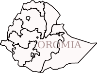
- Ethiopia Regional Boundary
- Date
- April 3, 2020, 8:24 a.m., Publication
- Abstract
- Source: ethioGIS
Projected Coordinate System: Adindan_UTM_Zone_37
- Edition
- --
- Owner
- tsegaye
- Point of Contact
- Ayele
- tsegayeayele840@gmail.com
- Purpose
- COVID 19 Analysis and Mapping
- Maintenance Frequency
- unknown
- Type
- vector
- Restrictions
- formal permission to do something
- License
- Public Domain
- Language
- eng
- Temporal Extent
- Start
- --
- End
- --
- Supplemental Information
- The data is Accessed from EthioGIS PIC and used by GII
- Data Quality
- --
- Extent
-
- long min: -162404.536499999000000
- long max: 1491092.296200000000000
- lat min: 375657.868699998000000
- lat max: 1641359.808000000000000
- Spatial Reference System Identifier
- EPSG:20137
- Keywords
- no keywords
- Category
- Boundaries
- Regions
-
Ethiopia